Comparing satellite and ground-based measurements of DLI
 Micah Woods and Tom Cook on a sunny late August day in Corvallis, Oregon
You’ve seen the Global DLI app that uses satellite data from the NASA POWER Agroclimatology dataset to show a summary of photosynthetically active radiation—expressed as the daily light integral, or DLI—for the past year at any location.
.](/post/satellite-ground-based-dli/corvallis_dli_hu6b7664f523075193f9f11d79c1c9dcfa_319241_54bd05bf4fb59059ffb861580a1a2a8a.webp)
Have you wondered how the satellite measurements of DLI compare with ground-based measurements of the same thing? I looked up data for some locations in the USA.
The NASA POWER data are on 0.5° by 0.5° grid, while the ground-based measurements are at a single weather station within a grid. I downloaded daily measurements for the year 2020 from six US Climate Reference Network (USCRN) stations and also got the NASA POWER daily measurements for the grid section containing each station.
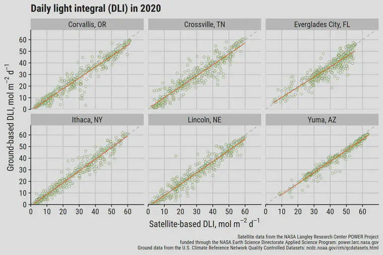
The root mean square error (RMSE) in 2020 at these six locations ranged from 3.8 mol m-2 d-1 at Yuma to 5.7 mol m-2 d-1 at Everglades City.
On a monthly basis in 2020, the RMSE ranged from 1.5 in Ithaca to 3.5 in Corvallis.
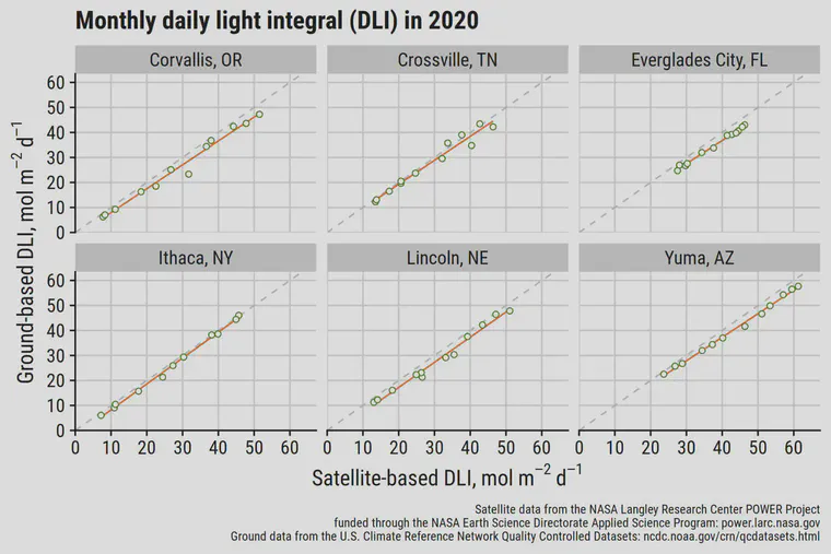
There is a slight bias with the satellite measurements to report a higher DLI at these locations.
The satellite measurements look pretty accurate to me. On a daily basis, I expect the satellite-based DLI for the encompassing grid will be, more often than not, within 5 mol m-2 d-1 of the actual DLI on the ground at a single location within that grid. And when looking at the average over time, the DLI by satellite is going to be even more accurate.